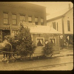
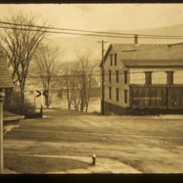
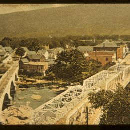
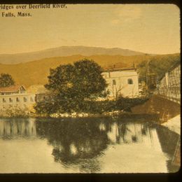
Shelburne Falls & Colrain Railroad Vintage Photos and Notes


Follow the Trolley Guide

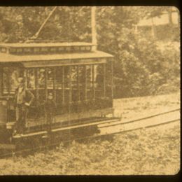
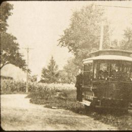
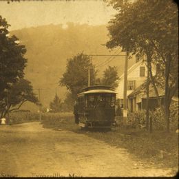
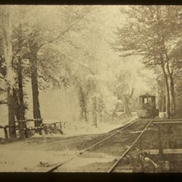
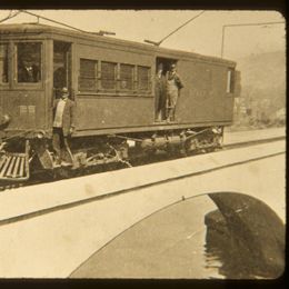
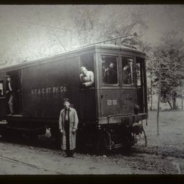
From 1896 to 1927, the Shelburne Falls and Colrain Street Railway (“SF&C”) carried freight and passengers on a trolley line between Colrain and Shelburne Falls, Massachusetts.

The very first trolley car that ran the route, Car No. 10, has been preserved and restored, and it is possible to ride it on a small stretch of track at the Shelburne Falls Trolley Museum. But what about the rest of the historic trolley route?

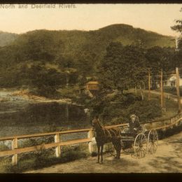
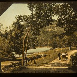
Although the original tracks and most of the equipment of the SF&C are long gone, it is possible to follow much of the original route, starting at its far end in the picturesque town of Colrain, along the North River then the Deerfield River to the village of Shelburne Falls, past the renowned Bridge of Flowers and up to the Shelburne Falls Trolley Museum, home of Car No. 10, the SF&C’s first trolley car.

This guide describes the route and the points of interest along the way. The entire trip is less than seven miles. Important: From Colrain to Shelburne, the tour follows a country road that has fairly few good places to park safely off the road.


*We urge you to stay in your car until you reach the village of Shelburne Falls at Stop 12 of the tour. There are parking places in Shelburne Falls, and the tour stops at 13 and 14 can be reached on foot to the Trolley Museum (Stop 17).


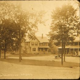
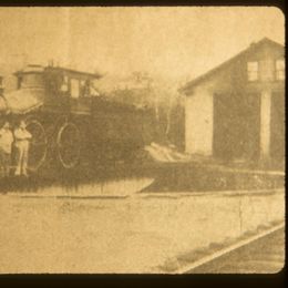
Start in the center of the town of Colrain at the intersection of MA Route 112 and Greenfield Road, at Colrain Veterans Memorial Park, a small area in the middle of the intersection. Opposite the Memorial Park, next to the Colrain Brick Church is a grassy area that was once the SF&C Trolley Barn, where the trolley would stay overnight. Head South on Route 112. On your left is the William Pitts House, which is now the Colrain Historical Society (open by appointment: [email protected]).

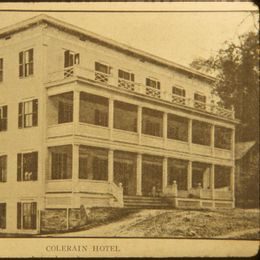
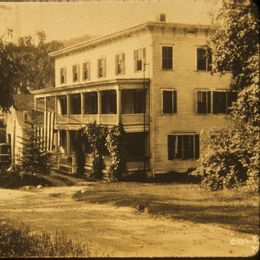
1: Colrain Hotel

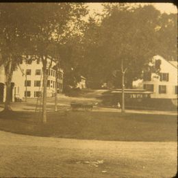
2: Colrain Common
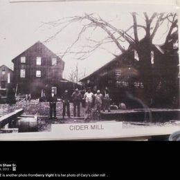
The Carey Cider Mill, which processed millions of apples into cider and cider vinegar, (up to about 1,000 barrels per year) was a short way down Foundry Village Road and up York Road. Apples, cider and vinegar were regular parts of the freight carried on the SF&C.
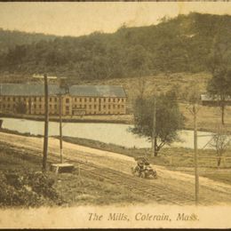
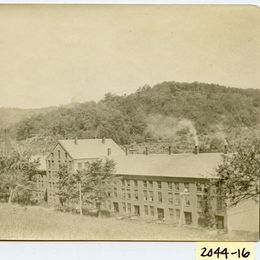
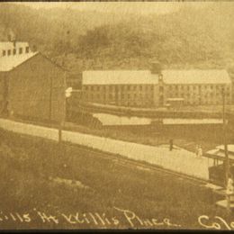
The Willis Place, was the site of a textile mill and feeder pond. The site is now used for pallet production.
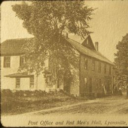
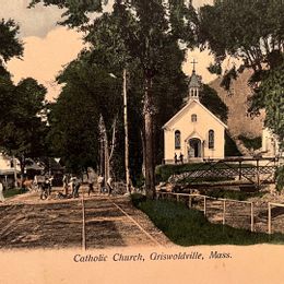
On your right, the green and white painted building with two dormers over the two front entrances used to be Red Man’s Hall, a meeting place for a civic men’s group. It was probably a chapter of the Improved Order of Red Men, a fraternal organization claiming descent from the colonial Sons of Liberty.

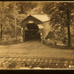
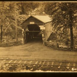
Looking down Lyonsville Road you can see the Arthur Smith Covered Bridge. The bridge used to be located a distance from its current site. People used it daily to bring freight across the river and to the trolley.
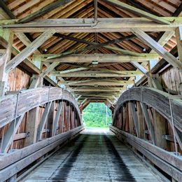
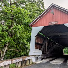
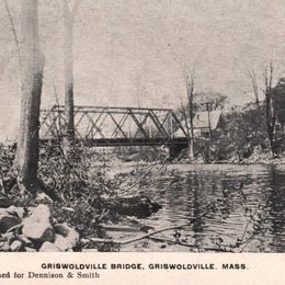
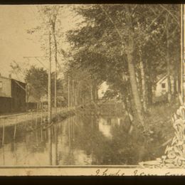
From Route 112, to your right you can see the Griswoldville Bridge (when you arrive at the end of the tour at the Shelburne Falls Trolley Museum, you can see a photo of the same bridge.). To your left is a canal that served the textile mills along the river.
1: Covered Bridge
2: Griswoldville Bridge

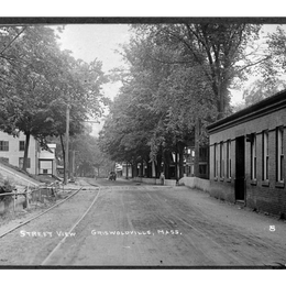
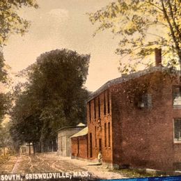
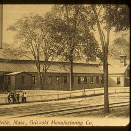
When the SF&C was running, a large brick textile mill extended all along this side of the road. The two blue buildings now on the spot produced textile products up until 2025.

1. Griswoldville Covered Bridge - potentially Adamsville Rd

2. Looking North 

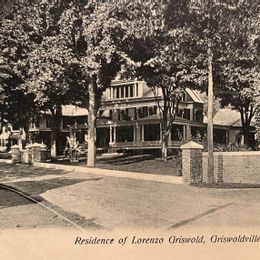
3. Griswold Manufacturing 
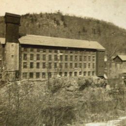
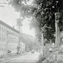
On your left is Ray’s Market, which was a small store that served as the Shattuckville Post Office. The sign for the store is still visible on the south side of the building. Near Ray’s market, the Shattuckville Yarn Mill was a large building overhanging the North River. The site is now overgrown with trees and underbrush.
The SF&C, like many trolley lines, maintained a picnic or park area. Hillside Park, owned by the SF&C, was located off Charlemont Road, just up on the left. The Park was a popular holiday and weekend destination on the trolley for ball games, concerts and occasional carnivals. The concerts no doubt included performances by the Shelburne Falls Military Band, which still performs in and around Shelburne Falls to the present day.
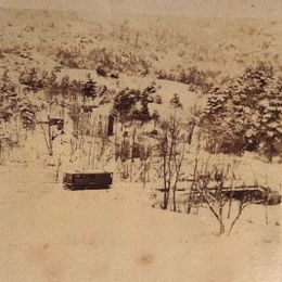
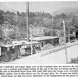
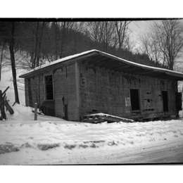
This is the site of the SF&C’s original hydropower station.  It generated the electricity that first powered the trolley. Later a coal powered generating plant here supplemented the hydro power.  The car storage and repair shops were also located here. 
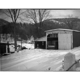
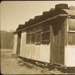
On the other side of the North River Bridge, on the right, you can see the Johnson Farm, now called Good Bunch Farm. This is the farm where Car Number 10 (now the pride of the Trolley Museum) was stored for 65 years. If you crossed the North River Bridge to see the farm when their open flag is outis up, return across the bridge and turn right (south) to continue along Route 112
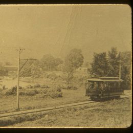
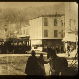
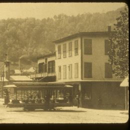
At the small grassy park or common, turn right onto Water Street. When the trolley ran through here, a church was on this site. Nearby was the Baker School; some of its students used the Trolley as their school bus. This park is now the home of the Shelburne Falls Farmers Market, and is opposite the Shelburne Falls Community Center, site of many local events and celebrations.
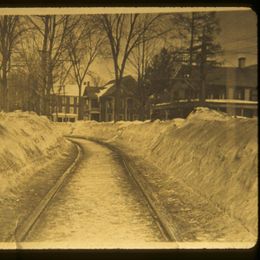
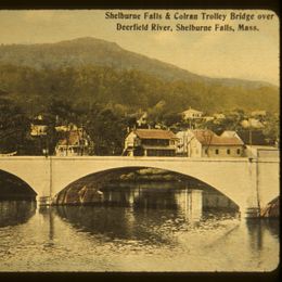
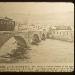
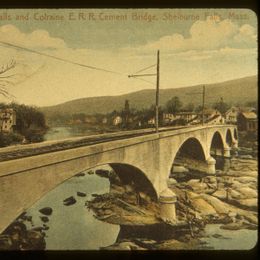
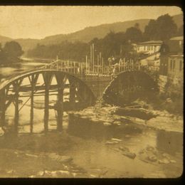
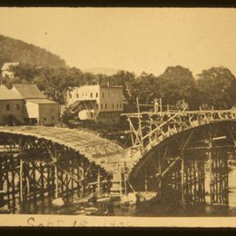
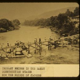
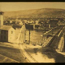
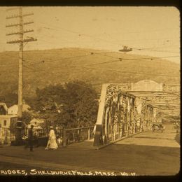
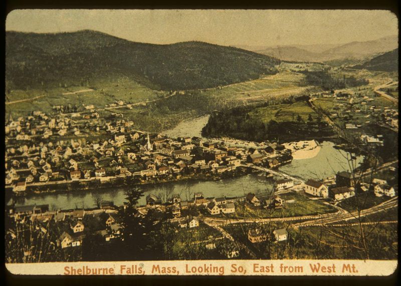
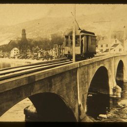
The village of Shelburne Falls is shared between two towns: Shelburne (on the East side of the Deerfield River) and Buckland (on the West Side of the River). From 1897 to 1908, the SF&C ran from Colrain only to Shelburne, since there was not a bridge strong enough to carry the trolley cars to the Buckland side of the river. At the end of the trolley line, freight was unloaded at the Shelburne terminus and carted by wagon across the river to the train station. At the station, in Buckland, freight was loaded onto trains of the Boston & Maine and New York, New Haven & Hartford railroads. In 1908, the SF&C constructed a bridge specifically for the trolleys. When the SF&C was shut down in 1927, the trolley bridge remained in place. In 1929, the Shelburne Women’s Club adopted the bridge, filled it with more than eighty loads of loam and fertilizer and planted flowers along its length. The result is the Bridge of Flowers, which can include over 500 varieties of flowers and plants, visited by more than 100,000 people each year. If you don’t want to interrupt your tour at this stop to cross the Bridge of Flowers, you can visit the Bridge of Flowers at Stop 15 or at the end of this tour. Make sure you don’t miss it! After this stop, continue 450 feet down Water Street and across Bridge Street onto Deerfield Avenue
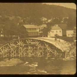
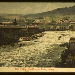
Before the trolley bridge was built, freight was unloaded at a freight house at the end of the trolley line and carted across the river to the train station. The freight house is now a bakery and cafe named “Baked.” While you are on Deerfield Avenue, continue a few more feet down to the viewing area next to the river. At the viewing area, you can see the Salmon Falls and the “Glacial Potholes,” one of the largest collections of natural potholes in the world, including the largest natural pothole on record. The potholes, known as “kettles” in geological terminology, are created by the effect of the eddy water of the falls grinding out circular depressions or potholes in the rock. Always a wonderful sight, the falls and the potholes are particularly impressive during the spring snow melt, when the river is at its highest. If you would like to take a break, the shops and restaurants on this side of the river are right on Bridge Street, around the corner from the Falls. More shops and food options are available across the river, which you can reach by turning left on Bridge Street and crossing the automobile bridge (the “Iron Bridge”)
When you cross the bridge, you arrive in the Town of Buckland, which comprises the western half of the village of Shelburne Falls. At the end of the bridge, if you turn to your right, you will see the far end of the Bridge of Flowers. If you didn’t take time to see the Bridge of Flowers at Stop 13, now is a good time to visit it. If you look to the left (South) from the end of the bridge, State Street (where the bridge ends) divides into two different streets at the foot of a hill. The lowest street, which continues along the Deerfield River, is Conway Street, which goes to shops in the mill complex that was the original home of the Lamson & Goodnow cutlery company. Their factory store is still located there, along with a bookstore and several craft and artisan workshops. The next street up from the river is Ashfield street, Depot Street, which is the shortest way to the Shelburne Falls Trolley Museum branches left off of Ashfield street about 100 feet up. Instead of taking this short cut, head up Ashfield Street, which goes up toward the railroad crossing past the big white building that houses the Salmon Falls Gallery. The Salmon Falls Gallery building was originally a grain store, with grain arriving on the main line from midwestern farms. The building now includes the Blue Rock restaurant and a wonderful art and craft gallery, which features work by the internationally famous glass artist, Josh Simpson.
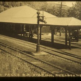
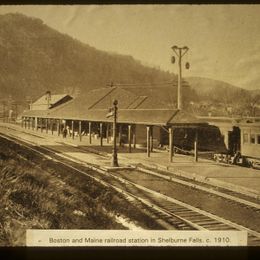
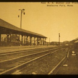
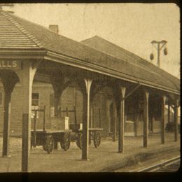
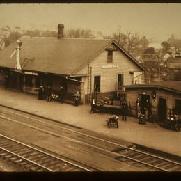
The Shelburne railroad station, Union Station, was located in the area of the Salmon Falls Gallery parking lot. After the trolley bridge was built in 1908, the trolley line came up to the railroad tracks at the station along what is now Depot Street. If you continue through the Salmon Falls Gallery parking lot, the Trolley Museum grounds begin.
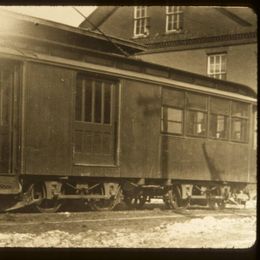
This is the last stop on the tour, with many things to see and do. As you continue toward the Trolley Museum building, on either side of the short entrance road, you will see a number of trolley and railroad cars with historical significance. On the left is the 1866 Troy & Greenfield RR Freight House which was built before the first train arrived in 1867. Goods from the Trolley were stored at the Freight House until they could be transferred to one of the trains arriving at Union Station or placed into waiting freight cars. Just past the Freight House, on the left, is a caboose, number CV 4015. It was built in 1925 by the Central Vermont Railway. Cabooses were placed at the ends of freight trains, and served as homes-away-from-home and offices for conductors and brakemen. They had stoves and desks for the train crew, and beds for resting between trips. This caboose worked on the Central Vermont Railway between St. Albans, VT, and New London, CT, passing through western Massachusetts regularly. It came to the museum in 2000, where it was restored to its mid-1950's appearance. You may explore inside this caboose during regular museum hours. Straight ahead at the end of the entrance road is the Trolley Museum building. If you haven’t done so already, go into the Trolley Building to purchase museum tickets, which include an all day pass to ride on the Trolley’s greatest treasure, and the centerpiece of the Museum’s collection, Trolley No. 10. Built in 1896 by Wason Manufacturing in Springfield, MA, it carried freight and passengers on the SF&C for thirty years. When the SF&C closed, the body of the trolley was purchased by a local farm family, the Johnsons, to use as a chicken coop. It stayed for over six decades at a site near the North River Bridge at Stop 11 of this tour. The car body was donated to the museum in 1992 by Marshall Johnson, whose father purchased it in 1928 after the trolley company ceased operations. From 1992, founders of the Museum, through donations, grants and volunteer work, restored Trolley No. 10 to pristine condition. On October 9, 1999, a proudly reborn car No. 10 made its formal return to operation. With your Trolley Museum admission ticket, you will have a chance to ride No. 10 and get the entire story from your conductor. Your ticket also entitles you to a ride (if you help to pump) on the Museum’s classic pump car, and on select days each month, to ride on a motorized “Speeder,’ one of the vehicles that replaced pump cars for track inspection and maintenance. The Trolley Museum also has displays describing the history of Trolley No. 10, the SF&C and photos and information about related history, like the building of the Hoosac railroad tunnel through the Berkshire Mountains just west of Shelburne Falls. You can also look into the museum’s car barn, where ongoing long-term restoration projects are refurbishing two historic cars, the “Berkshire Hills” parlor car and MBTA Line Car 3823. The "Berkshire Hills" is an elegant parlor trolley car built for the Berkshire Street Railway by Wason Manufacturing (Springfield, Mass.) in 1903. It served in extra-fare and charter service until 1917, then was a diner in Pittsfield, Massachusetts for many years. After a structure fire in the 1990's, it was donated in 1995 to Seashore Trolley Museum (Kennebunkport, Maine). Seashore donated the "Berkshire Hills" to the Shelburne Falls Trolley Museum in 2023. The Seashore Trolley Museum also donated MBTA Line Car 3283 to the Shelburne Falls Trolley Museum in 2023. It needs extensive roof repairs, exterior siding and electrical work. Line cars were mobile workshops, with platforms on the top of the car to allow workers to easily reach the wires above the trolleys which contain the electricity needed to power the trolley’s electric motors. The wheeled device or “trolley” that rests on the wire and connects the car to its power line, is the reason why trolley cars are named trolley cars.
After the Last Stop

This self-guided tour ends at the Trolley Museum, but there is more to do with your day in Shelburne Falls. You can visit the craft and artisan shops at the Mill complex on Conway Street, just below the Trolley Museum, mentioned in the description of Stop 15 of the tour.

Afterwards, you can take the short path behind the Mill shops down to the Deerfield River below the falls. When you come back up the hill, walk back to Stop 15, at the entrance to the Bridge of Flowers and the Iron Bridge; there are more shops and restaurants near and on the way there.

If you cross either the Iron Bridge or the Bridge of Flowers, you can explore the Shelburne side of the village further.

The Visitor Information Center on Bridge Street has more information about places to eat, shops to visit in and around Shelburne Falls.

You can stop for ice cream at the soda fountain in Baker’s Pharmacy, or check the marquee boxes on the front of Memorial Hall in Shelburne to see what is happening at the Shelburne Falls Theater, the community theater on the second floor of the Hall.

You can walk down the narrow alley from Bridge Street to the Shelburne Falls Bowling Alley, the second oldest bowling alley in the country, for some candlepin bowling, or walk down Deerfield Street for another chance to enjoy the view of Salmon Falls and the Glacial Potholes. Take a selfie or two overlooking the falls and tell your friends about your day following the trolley.

Thank you for taking this journey with us.